Cluster Overview
-
-
In this section you can find detailed information on the different map clusters we provide. If you need more Information on what map clusters are, which API to use or the difference between the url schemes. Then you can find this in the Essential Information.
Please note that the links provided in the tables below may require authentication. Enter username=xtok and password="yourtoken". You can find your Token here.
-
PTV xServer internet with API Version 1
-
PTV World City Map (TOMTOM)
-
- Map and Content Info:
Production System: PTV_World_City_Map_Premium_2024_1T
Test system: PTV_World_City_Map_Premium_2024_1T - Available xServer, Add-ons and Profiles: Production System | Test System
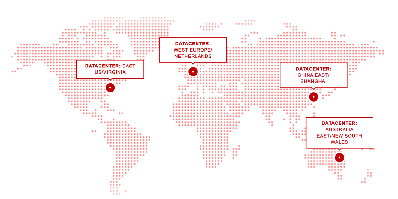
Datacenter
- eu: West Europe / Netherlands
Url schemes
You can access the PTV xServer internet world city map with two different url schemes:
- The routed url scheme: api(1-4)(-test).cloud.ptvgroup.com
- The datacenter url scheme: api-eu(-test).cloud.ptvgroup.com
Need more information about Url schemes? Have a look in our Essential information section.
Management Console for xMap, xLocate, xRoute, xMatchMap and xTour
- Production https://api.cloud.ptvgroup.com/
- Integration: https://api-integration.cloud.ptvgroup.com/
- Test: https://api-test.cloud.ptvgroup.com/
PTV xServer features for PTV World City Map
- Geocoding/Reverse Geocoding: It is recommended to use Multi Field Search with Country Code
- Mapping: The Rendering of Feature Layer Themes depends on the availability in the respective region
- Routing: Intercontinental routing is possible between Europe, Middle East and Africa. Further intercontinental and continental routing will be possible as provider connections are present. Toll calculation available for Europe including PTV toll with regular updates.
- Trip Planning: Continental Trip planning
- Map Matching Continental Mapmatching
Downloads
- xMap: C#/Java Clients | Javascript Client | Profile Snippets | Leaflet | Leaflet-min
- xLocate: C#/Java Clients | Javascript Client | Profile Snippets
- xRoute: C#/Java Clients | Javascript Client | Profile Snippets
- xMatchmap: C#/Java Clients | Javascript Client | Profile Snippets
- xTour: C#/Java Clients | Javascript Client | Profile Snippets
Explore
- Map and Content Info:
-
-
PTV Europe City Map (TOMTOM)
-
- Map and Content Info:
Production System: PTV_Europe_City_Map_Premium_2024_1T
Test System: PTV_Europe_City_Map_Premium_2024_1T - Available xServer, Add-ons and Profiles: Production System | Test System
Datacenter
- West Europe / Netherlands
Url scheme
You can access the PTV xServer internet Europe City map with the following url scheme:
- <service>-eu-n(-integration).cloud.ptvgroup.com
with service being either xmap, xlocate, xroute, xmapmatch or xtour. Optionally append -integration to send requests to the corresponding test system.
For compatibility reasons, the service names ajaxmaps, ajaxfg and ajaxbg(1-4) are supported as well and can be used as an alias for xmap. To bybass browser restrictions with domain sharding, use ajaxbg(1-4).
Management Console
- Production: xMap | xLocate | xRoute | xMapmatch | xTour
- Integration: xMap | xLocate | xRoute | xMapmatch | xTour
- Test: xMap | xLocate | xRoute | xMapmatch | xTour
Downloads
- xMap: C#/Java Clients | Javascript Client | Profile Snippets | Leaflet | Leaflet-min
- xLocate: C#/Java Clients | Javascript Client | Profile Snippets
- xRoute: C#/Java Clients | Javascript Client | Profile Snippets
- xMatchmap: C#/Java Clients | Javascript Client | Profile Snippets
- xTour: C#/Java Clients | Javascript Client | Profile Snippets
Explore
- Map and Content Info:
-
-
PTV Europe City Map (HERE)
-
- Map and Content Info:
Production System: PTV_Europe_City_Map_Premium_2024_1H
Test System: PTV_Europe_City_Map_Premium_2024_2H - Available xServer, Add-ons and Profiles: Production System | Test System
Datacenter
- West Europe / Netherlands
Url scheme
You can access the PTV xServer internet Europe City map with the following url scheme:
- <service>-eu-h(-integration).cloud.ptvgroup.com
with service being either xmap, xlocate, xroute, xmapmatch or xtour. Optionally append -integration to send requests to the corresponding test system.
For compatibility reasons, the service names ajaxmaps, ajaxfg and ajaxbg(1-4) are supported as well and can be used as an alias for xmap. To bybass browser restrictions with domain sharding, use ajaxbg(1-4).
Management Console
- Production: xMap | xLocate | xRoute | xMapmatch | xTour
- Integration: xMap | xLocate | xRoute | xMapmatch | xTour
- Test: Management Console
Downloads
- xMap: C#/Java Clients | Javascript Client | Profile Snippets | Leaflet | Leaflet-min
- xLocate: C#/Java Clients | Javascript Client | Profile Snippets
- xRoute: C#/Java Clients | Javascript Client | Profile Snippets
- xMatchmap: C#/Java Clients | Javascript Client | Profile Snippets
- xTour: C#/Java Clients | Javascript Client | Profile Snippets
Explore
- Map and Content Info:
-
-
PTV North America City Map + PTV South America City Map (HERE)
-
- Map and Content Info:
Production System: PTV_America_City_Map_Premium_2023_2H
Test System: PTV_America_City_Map_Premium_2023_2H - Available xServer, Add-ons and Profiles: Production System | Test System
Datacenter:
- East US/Virginia
Url scheme
- You can access the PTV xServer internet North America City map with the following url scheme: <service>-na-n(-test or -integration).cloud.ptvgroup.com
with service being either xmap, xlocate, xroute, xmapmatch or xtour. Optionally append -test or -integration to send requests to the corresponding test system.
For compatibility reasons, the service names ajaxmaps, ajaxfg and ajaxbg(1-4) are supported as well and can be used as an alias for xmap. To bybass browser restrictions with domain sharding, use ajaxbg(1-4).
Management Console
Downloads
- xMap: C#/Java Clients | Javascript Client | Profile Snippets | Leaflet | Leaflet-min
- xLocate: C#/Java Clients | Javascript Client | Profile Snippets
- xRoute: C#/Java Clients | Javascript Client | Profile Snippets
- xMatchmap: C#/Java Clients | Javascript Client | Profile Snippets
- xTour: C#/Java Clients | Javascript Client | Profile Snippets
Explore
- Map and Content Info:
-
-
PTV Australia City Map (HERE)
-
- Map and Content Info:
Production System: PTV_Australia_City_Map_Premium_2023_2H
Test System: PTV_Australia_City_Map_Premium_2023_2H - Available xServer, Add-ons and Profiles: Production System | Test System
Datacenter:
- Australia East/New South Wales
Url scheme
- You can access the PTV xServer internet Australia City map with the following url scheme: <service>-au-n(-test or -integration).cloud.ptvgroup.com
with service being either xmap, xlocate, xroute, xmapmatch or xtour. Optionally append -test or -integration to send requests to the corresponding test system.
For compatibility reasons, the service names ajaxmaps, ajaxfg and ajaxbg(1-4) are supported as well and can be used as an alias for xmap. To bybass browser restrictions with domain sharding, use ajaxbg(1-4).
Management Console
Downloads
- xMap: C#/Java Clients | Javascript Client | Profile Snippets | Leaflet | Leaflet-min
- xLocate: C#/Java Clients | Javascript Client | Profile Snippets
- xRoute: C#/Java Clients | Javascript Client | Profile Snippets
- xMatchmap: C#/Java Clients | Javascript Client | Profile Snippets
- xTour: C#/Java Clients | Javascript Client | Profile Snippets
Explore
- Map and Content Info:
-
-
PTV TLN Europe City Map (HERE)
-
- Map and Content Info:
Production System: PTV_Europe_City_Map_Premium_2024_1H
Test System: PTV_Europe_City_Map_Premium_2024_2H - Available xServer, Add-ons and Profiles: Production System | Test System
Datacenter:
- West Europe/Netherlands
Url scheme
- You can access the PTV xServer Internet TLN map with the following url scheme: <service>-tln-eu-n(-test or -integration).cloud.ptvgroup.com
with service being either xmap, xlocate, xroute, xmapmatch or xtour. Optionally append -test or -integration to send requests to the corresponding test system.
For compatibility reasons, the service names ajaxmaps, ajaxfg and ajaxbg(1-4) are supported as well and can be used as an alias for xmap. To bybass browser restrictions with domain sharding, use ajaxbg(1-4).
Management Console
Downloads
- xMap: C#/Java Clients | Javascript Client | Profile Snippets | Leaflet | Leaflet-min
- xLocate: C#/Java Clients | Javascript Client | Profile Snippets
- xRoute: C#/Java Clients | Javascript Client | Profile Snippets
- xMatchmap: C#/Java Clients | Javascript Client
- xTour: C#/Java Clients | Javascript Client | Profile Snippets
Explore
- Map and Content Info:
-
PTV xServer internet with API Version 2
-
PTV World City Map (HERE)
-
- Map and Content Info: Production System | Test System
- Available xServer URLs and Profiles: Production xServer URLs and Profiles | Test xServer URLs and Profiles
Datacenters:
- West Europe / Netherlands and East US / Virginia
Url schemes
You can access the PTV World City map with two different url schemes:
- The routed url scheme: https://xserver2(-test).cloud.ptvgroup.com
- The datacenter url scheme:
Datacenter Europe: https://xserver2-eu(-test).cloud.ptvgroup.com
Datecenter USA: https://xserver2-us(-test).cloud.ptvgroup.com
Need more information about Url schemes? Have a look in our Essential information section.
Dashboard
- Test system: https://xserver2-test.cloud.ptvgroup.com/dashboard/Default.htm#Administration/Services.htm
- Productive system: https://xserver2.cloud.ptvgroup.com/dashboard/Default.htm#Administration/Services.htm
PTV xServer Features
- High Perfomance Routing: HPR graphs available for the geographic region Europe (ZZ_EUR). HPR graph available for the following Profiles including the PTV_Truck_Attributes: tuck40t.xml, truck11_99t.xml and truck7_49t.xml. Customers who like to use the HPR graphs need to specify some settings in the xServer requests. For more information have a look at this blog post.
For further information about the existing services and functionalities please refer to the Release Notes.
Explore
-
-
PTV China Map (eMapGo)
-
- Map and Content Info
- Production System | Test System
- Available xServerURLs and Profiles: Production xServer URLs and Profiles | Test xServer URLs and Profiles
Datacenters:
- China East / Shanghai -cn
Please note that the PTV xServer internet test system serving the China Map must not be used within any productive system and is intended for testing purposes only. Any application using this test system shall not be publicly visible. Certain restrictions apply; the regulations for operating services incorporating geographic data of China can be found here: http://www.npc.gov.cn/englishnpc/Law/2007-12/12/content_1383865.htm
Url schemes
The datacenter url directly addresses an xServer internet datacenter.
- The datacenter url scheme: xserver2-cn-(test).ptvgroup.cn
Need more information about Url schemes? Have a look in our Essential information section.
Management Console
- Test system: https://xserver2-cn-test.ptvgroup.cn/
- Productive system: https://xserver2-cn.ptvgroup.cn/
PTV xServer Features
- Coordinate Transformation: Chinese legislation requires that all digital map data is stored in China in a specific coordinate system. To transform your coordinates to this system, we are providing a coordinate transformation service from WGS84 to chinese proprietary coordinate system. You will find further informations in this following documentation: PTV xServer Coordinate Shifting Service
- Geocoding: findAddressByText() is the only enabled xLocate method and returns country, postal code, city, city district, street, house number and coordinate. The data stock does include POIs and adress points. Reverse geocoding is not available. The geocoder will work on syllables. Since the Chinese characters consists of syllables, the geocoder in the first version may not select syllables related to streets or cities only. With this the selection might be very large. But the best match will appear still first.
- Mapping: The Rendering is possible for the whole of China. Please be aware to use the proprietary Chinese coordinate system as input format.
- Routing: The Routing is possible for the whole of China. Please be aware to use the proprietary Chinese coordinate system as input format.
- Trip Planning: The Trip Planning is possible for the whole of China. Please be aware to use the proprietary Chinese coordinate system as input format.
For further information about the existing services and functionalities please refer to the Release Notes.
Explore
-